Apple’s iOS 6 Maps arrive; the world responds. How should your transit agency?
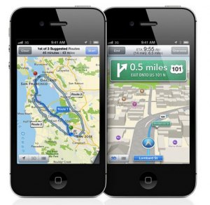
 Last week, Apple released iOS 6, the latest version of the operating system that runs on iPhones, iPods, and iPads. As anticipated, the installed “Maps” application was overhauled: it uses different data sources, adds some features, and removes other features — specifically built-in transit directions (Trillium has previously reported on this, “Apple’s iOS 6 Maps: its implications for transit agencies, developers, and customers”). The level of mainstream media attention given to the overhaul of the Maps application in iOS 6 shows how important maps and navigation features are.
Despite the impressive visual features, the reception of Apple’s iOS 6 maps has been largely critical so far because of issues with accurate data:
- New York Times (19-Sep-2012), “Apple’s iPhone Update Leaves Out Google’s Maps”: “…some have found that searches for an in-town destination can pull up an entirely different city, and there is no built-in information about public transportation.”
- New York Times (20-Sep-2012), “Apple on Its iOS 6 Maps: Things Can Only Get Better”: “‘We launched this new map service knowing that it is a major initiative and we are just getting started with it,’ said Trudy Muller, an Apple spokeswoman. ‘We are continuously improving it, and as Maps is a cloud-based solution, the more people use it, the better it will get. We’re also working with developers to integrate some of the amazing transit apps in the App Store into iOS Maps. We appreciate all of the customer feedback and are working hard to make the customer experience even better.'”
- Huffington Post (19-Sep-2012): “iOS 6 Maps Comes Without Transit Directions, A Wrong Turn For Apple And iPhone Users”
- New York Times: Japanese Look for Alternatives to Apple’s Maps”
TheTransitWire.com also offers a roundup: “New iPhone maps miss the boat”
Google has invested significant human and technical effort into their Maps product since its launch in 2005, seven years ago. An excellent article in The Atlantic, “How Google Builds Its Maps—and What It Means for the Future of Everything” gives a behind-the-scenes view of the effort that goes into Google Maps.
We will see how Apple’s Maps evolve.
 In the meantime, Google is working on a new Maps application for iOS that should be available before the end of the year (New York Times Bits Blog). And the removal of transit routing from Apple’s Maps are creating a boon for 3rd party transit app developers, Kevin Webb and I predicted:
- The Transit App Embark has seen more than 100,000 downloads in less than a week since iOS 6 launched (Techcrunch).
- New transit apps are becoming available, like Lumatic City Maps
What can transit agencies do to respond to the change in iOS 6 Maps, and continue to make it easier for their iPhone/iPad/iPod-using customers to navigate transit services? Here are steps that transit agencies can take:
- Be prepared to respond to your customers that ask about iOS 6. Put a news bulletin on your agency website, blog, or social media account; prepare an email template; feel free to refer your customers to resources on the Trillium blog or elsewhere online.
- Make your General Transit Feed Specification (GTFS) data public. This will enable developers to include your transit agency’s service information in their applications. Here are examples of approaches for communicating about public GTFS data: Mendocino Transit Authority and Oregon Department of Transportation. Read more about making GTFS data public and opening the door to transit applications in Trillium’s report “Opportunities to Leverage GTFS”. If your transit agency’s data is public, it should show up on OpenPlans’ Transit Data Dashboard, and will be included in their upcoming iOS 6 application that uses OpenTripPlanner.
- Create a Transit App Center (example from Mendocino Transit Authority). “App Centers” are not just for the big agencies anymore. Trillium is available to create an App Center for your agency.
The whole “make GTFS data public” thing is the single best thing agencies can do. It costs nothing, and there any many app-makers out there who include every public feed they can.
On a wider note, it’s interesting that Google has ended up with de facto exclusive rights to certain agencies – not because Google wanted it, but because the agencies chose it!